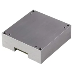
 U16488-D High Precision 10-Axis Mems Imu Inertial Measurement Module for Navigation and Motion Control
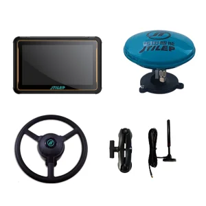
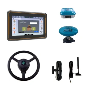 Farm Navigator Auto Steering System Tractor GPS Navigation
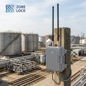
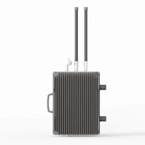 0.5~20 Km Long Range Fixed Drone Spoofer Gnss GPS Glonass Spoofer Anti Drone Navigation Spoofer
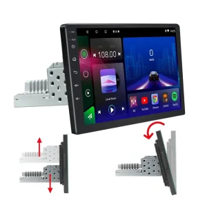
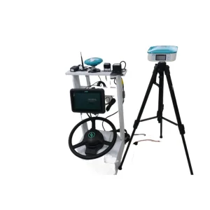 Tractor Navigation Dosing Seeding Harvesting Trip Recorder Farm
As the largest landlocked country in the world, Kazakhstan presents unique logistical and geographical challenges that demand sophisticated navigation and mapping hardware. From the vast agricultural steppes of the North to the complex oil and gas infrastructure in the Caspian region, the demand for precision GPS, GLONASS, and MEMS inertial sensors is skyrocketing. As a leading manufacturer and supplier, we understand that Kazakhstan’s "Digital Kazakhstan" state program is driving a massive transition towards automated industrial workflows.
Our hardware solutions are engineered to withstand the extreme temperature fluctuations of the Kazakh climate—ranging from -40°C in the winter to +40°C in the summer. Whether it is for urban planning in Astana, mining operations in Karaganda, or logistics along the "Trans-Caspian International Transport Route," our hardware provides the reliability needed for high-stakes environments.
Full compatibility with GPS, GLONASS, BeiDou, and Galileo for seamless cross-border operation.
Optimizing Kazakhstan's grain belt with RTK precision and auto-steering systems.
Inertial measurement units (IMU) and drone defense for critical infrastructure protection.
Agriculture remains a pillar of the Kazakhstan economy. Our RTK-enabled tractor navigation systems allow farmers in regions like Akmola and Kostanay to achieve centimeter-level accuracy. This reduces fuel consumption, minimizes seed waste during sowing, and enables autonomous harvesting—crucial for managing the massive land plots typical of the region.
Kazakhstan's rich mineral resources require precise mapping hardware for open-pit mining and geological surveys. Our High Precision MEMS IMU modules provide stable motion control and position data for autonomous drilling rigs and heavy-duty mining haulers, ensuring safety and efficiency in remote sites.
Positioned as the bridge between Europe and Asia, Kazakhstan's transport sector relies on our Android-based vehicle navigation units. These systems are not just for maps; they integrate with fleet management software to provide real-time tracking across the vast distances between Almaty and Aktau.
With the increasing use of UAVs for pipeline monitoring and border security, our GNSS Spoofer and Anti-Drone systems are essential. They provide a protective layer for critical infrastructure against unauthorized drone incursions, a growing priority for Kazakh industrial security teams.
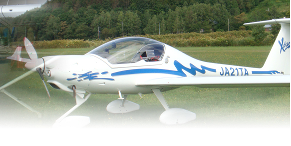
In 1996, Aero Apex was established with hopes to help those who fly have a "nice and safe flight." That desire has only become stronger every year and so we have especially focused on importing quality aircraft parts and related articles.
Throughout the years, we have encountered a variety of aircrafts from those older than 50 years to the most up-to-date models. Our years of experience in the industry enable us to give professional advice to customers in the navigation and mapping hardware sector. We live by the motto: "Do what you can today, today."
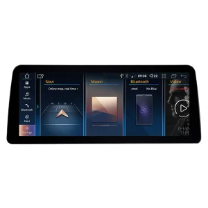
 12.3 Inch Rotatable Universal Android Car Head Unit - GPS Navigation & FM Radio Player
 Agricultural Rtk GPS Navigation for Tractors Agriculture Tractor
 Drone Navigation GPS/Glonass/Bd/Galileo Spoofer System
 Coika 12.3 Android Car GPS Navigation for BMW F30 F31 F32 F33 F34 F36 2012-2016 Carplay Radio Player
 New Design 1DIN Car Android Touch Screen 9 Inch GPS Radio Navigation
 7 "Carplay Portable Car Navigation Multimedia MP5 Multi-Function Connected Car Bluetooth
 Hot Selling 9-Inch Android Dual-Butt Universal Central Control Screen Car Carplay Navigation
 Silverstrong 4+64G Android 8core Car DVD Radio Multimedia Player GPS Navigation for Mercedes Benz C Class W204 S204 2011-2014 Ngt4.5 Carplay WiFi
The future of mapping hardware in Kazakhstan is moving towards integration with AI and 5G networks. In Almaty, the "Smart City" initiative is already leveraging IoT sensors and high-precision mapping to manage traffic and urban resources. For manufacturers, this means moving beyond simple GPS receivers to integrated multi-sensor fusion systems.
We are also seeing a shift towards localized GLONASS-K and BeiDou-3 hardware, which provides superior coverage in high-latitude regions like Northern Kazakhstan. Our commitment as a supplier is to provide the Kazakh market with the hardware that supports this digital sovereignty and technological independence.
By choosing our high-precision MEMS and GNSS hardware, companies in Kazakhstan are investing in a future where automation, precision, and safety go hand-in-hand. From aviation to the smallest tractor in the field, our mission remains the same: ensuring a "nice and safe flight" for every project.